Project Overview
Mapzine is an interactive web-based map application that visualizes global volcano data alongside population density information. Built using Python's Folium library, this project combines geographical data visualization with informative popups to create an engaging educational tool for geology enthusiasts, students, and researchers.
Technical Specifications
| Component |
Technology |
| Programming Language |
Python |
| Data Visualization |
Folium (Leaflet.js wrapper) |
| Data Processing |
Pandas |
| Data Formats |
CSV (volcano data), GeoJSON (population data) |
| Output |
Standalone HTML file with embedded JavaScript |
Key Features
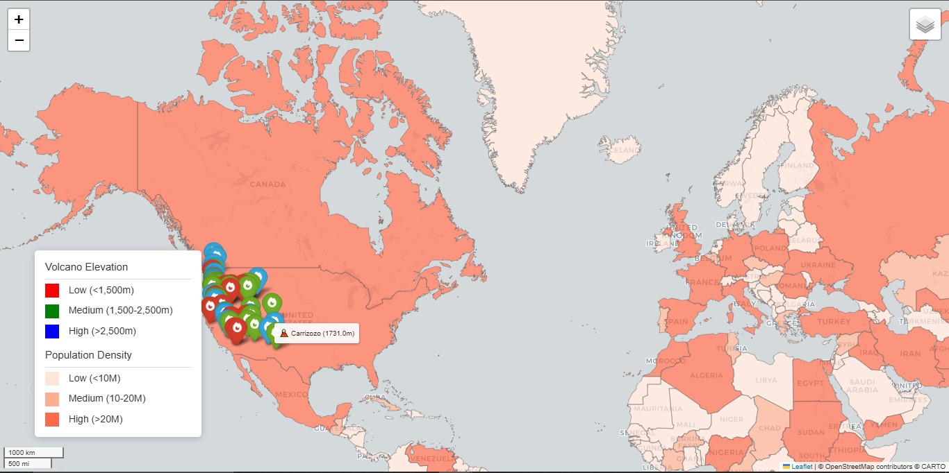
Volcano Visualization
- 1,500+ global volcanoes plotted
- Color-coded by elevation (red/green/blue)
- Custom fire icons from Font Awesome
Interactive Popups
- Detailed volcano information
- Elevation and coordinates
- Direct Google search links
Population Layer
- Choropleth map showing density
- Three-color gradient scheme
- Country-level tooltips
UI Enhancements
- Dual-layer control system
- Fixed-position legend
- Responsive design
Technical Implementation
Data Processing
import folium
import pandas

data = pandas.read_csv("volcanoes.txt")
lat = list(data["LAT"])
lon = list(data["LON"])
elev = list(data["ELEV"])
name = list(data["NAME"])
Marker Generation
def color_producer(elevation):
    if elevation < 1500: return "red"
    elif 1500 <= elevation < 2500: return "green"
    else: return "blue"

for lt, ln, el, nm in zip(lat, lon, elev, name):
    folium.Marker(
        location=[lt, ln],
        popup=folium.Popup(html=volcano_popup_html.format(...)),
        icon=folium.Icon(color=color_producer(el), icon='fire')
    ).add_to(map)
Challenges & Solutions
| Challenge |
Solution |
| Popup scrollbars disrupting UX |
Custom HTML with fixed dimensions |
| Slow rendering with 1,500+ markers |
Batch processing with generator functions |
| Colorblind accessibility |
High-contrast color palette selection |
| Mobile responsiveness |
Folium's built-in mobile adaptations |
Future Enhancements
- Real-time seismic data integration
- 3D elevation profiles
- User-submitted volcano photos
- Eruption history timelines
Back to Projects